Sunday, March 22, 2009

Springtime Geocaching

Ah, spring! A time when hope flows eternal. A time for renewal and re-growth. A time for geocaching without ticks, spiders, and mosquitoes.

Yesterday was a beautiful day here in Minnesota. The temperature peaked at near 70 degrees, and the snow that fell last November is almost gone.

We decided on one of the nearby regional parks, and like last week, the trails were ice packed and slippery. The ice had melted In places where the sun was able to shine through the trees, leaving slippery mud instead of ice. Some very tricky hiking, indeed!

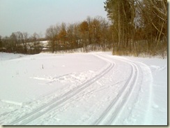
 Snowy Trails

The first cache we found was guarded by a dead squirrel. Seriously! It was actually a stuffed squirrel - as in taxidermy - and was part of the camo. But upon first spotting it, I couldn't tell. I poked it with a stick a few times, just to be sure.

The second cache we found was a very clever hide inside a great big tree beacon. We almost gave up on that one, when Wayfarer reviewed one of the recent posts describing how they had accidentally fond it.
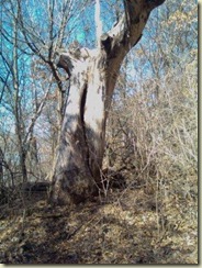
Big Geocache Beacon

The third was a micro hidden amongst the branches of another downed tree. Again, if not for the logs of previous finders, we may not have found that one. Definitely not winter friendly! On to number 300, which we found - but that's another story.

Monday, March 9, 2009

Massive Geocache Beacon

Here in the upper-midwest, geocaches are often hidden in, what is known as, a beacon.

Beacon:  [bee-kuhn]  a fire lit on the top of a hill as a signal

Okay, maybe a geocache beacon is not a fire, but in geocaching terms, certainly a signal. If you see the beacon, you should be able to find the geocache.

We recently found a geocache in the beacon shown below. If you were the hider, where would you put the geocache in this beacon?


Geocache Beacon

Sunday, March 1, 2009

More Island Geocaching

Well, it wasn't like this.

And it certainly wasn't like this.

But we did some island geocaching yesterday. The difference, this time we walked to the island.

I admit, that concept might confuse our faithful California readers. But around here, walking on water isn't an exercise reserved only for the Faithful. The water looked something more like this.

Lolas Lakehouse1

This is a shot of Lola's Lakehouse back on dry land.

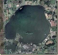
And here's an aerial view of the lake. Lola's was our starting point, directly south of the island. For reference, it is exactly 1/2 mile from shore to the island at that point.

Lake Waconia 1

We scored the two geocaches on the island, but the really cool part was the winter walk. (Sorry.) I'm talking about 18 degrees of cool - with a 10 MPH breeze. It was a brisk walk out there. Once in the shelter of the island, though, it was quite comfortable.

The island is hilly and crisscrossed with trails. Once we neared the caches we did some bushwhacking that took us through knee-deep snowdrifts.

in 1886, Lambert Naegle purchased the island in Waconia Lake for $5,200 and built on it a resort hotel. He named his resort the "Coney Island of the West." The name could have come from as many as three sources: 1)It was named after the more famous Coney Island of the East, in Brooklyn. 2)It is a shortened version of the town's name, Waconia. 3)It was named such after the area's high population of "conies," or rabbits.

In 1889 Reinhold Zeglin bought and operated the hotel complex. Legend has it that period celebrities such as Mark Twain and Al Capone visited during this period.

In the 1940s and 1950s, Frank "Shorty" Dvorak owned and operated the dining, dance, cottage, day camp, and launch facilities on the island.

Today, it's all in ruins - the resort cabins, lodge buildings, and homes.

Waconia Ruins 1

Waconia Ruins 2

Waconia Ruins 3

A great day of geocaching!

Sunday, February 1, 2009

Picking up Archived Geocaches

A few weeks back, one of our local geocachers passed away.  He had over 20 hides, several of which we had found. The rules at geocaching.com forbid anyone from adopting the caches, and the family didn't want continued emails when finds were logged on these caches. So the listings were all archived.

Now the containers are basically, litter.

We decided to go pick a couple up. I figured it was a nice thing to do, plus, those are good containers that can be recycled into new geocaches.

We knew exactly where a couple of them were, and wouldn't need a GPSr to to find them. The first one was a Park & Grab, but when we got there, it wasn't. Someone must have already picked it up.

The next one was a bit more remote - off the Luce Line Trail. Our readers may recall that we too have caches out on the Luce Line.

Geocaching Tracks in Snow

The snow was still pretty deep and we had to do a little snow-whacking to get to the hide.  But the container was there, and we picked it up.

It was a perfect day for a hike on the trail - the first day since winter began that the mercury had risen over 32 degrees.  The sun was shining, and as we walked I had to remove a layer to keep from over-heating. When we were getting close to the next hide, I asked Wayfarer to turn on the GPSr. We would need help in zeroing in on this one.

You may remember that we are now using Trimble's Geocache Navigator on Wayfarer's new Blackberry. Problem is (as we discovered while on the trail), Geocache Navigator does not list archived caches. Didn't even think of it until that moment.

And if you've ever tried accessing GC.com from a mobile device, you'd know that that's a losing cause. We turned around and headed back to the car.

Oh well, it was a good day for a walk in the woods. We'll have to go back some day soon.

Sunday, January 18, 2009

Geocaching and the Present Day Penny

When wayfarer and I get to the woods we like to "really get away". That is, to reach a time and space where our experience is not interrupted by road noise or jet planes. Where just the slightest hint of imagination could suggest that we've been transported. The forest is ancient, and the trail, timeless.

We still have those pesky satellites guiding us to the cache, but you get the point.

We almost achieved it today.

Our journey started in a very busy section of a close-by regional park. Hundreds of people were out enjoying the relative warmth of the 25-degree day. Some were cross-country skiing, others snowshoeing, and we were geocaching.

Winter Ski Trails (Click photos to enlarge)

Winter Ski Trails

To escape the long loops in the trail, and to avoid the many skiers, I suggested that we take a short cut across the end of a nearby lake.

Not such a good idea.

The snow was thigh deep the whole way. But we made it, found the cache, and signed the log. We both decided that this section of the park was just too busy for serious geocaching. So we jumped back into the car and headed to a more remote section.

Remote Trail Through the Pines

Winter Trail

Ah, this was more like it. The trail led us through thick stands of hemlock, white pines, aspen, and spruce. On the hilltops, the wind whistled eerily through needled branches, but the valleys were still and silent. The only sound was the snow crunching beneath our feet. This is what we were looking for. Alone, in a time and space that was just ours.

That is, until we rounded a corner and saw the present day penny that pulled us away from the place that we loved.

Penny to the Present

It was good while it lasted. We found the cache, signed the log, and made our way back to the car.

If you know the reference from which the present day penny came, make mention of it in your reply.

Ajax CommentLuv Enabled 60c1240b0ede1f711514d8b6dd4db92d


On Zazzle, Wayfarer is known as Paintingcoyote36. Check out this great items from her store.


make custom gifts at Zazzle

Listen to tonka_boy's playlist on Blip.fm

GeoCaching WebRing
GeoCaching WebRing by tmaster
[ Join Now | Ring Hub | Random | << Prev | Next >> ]